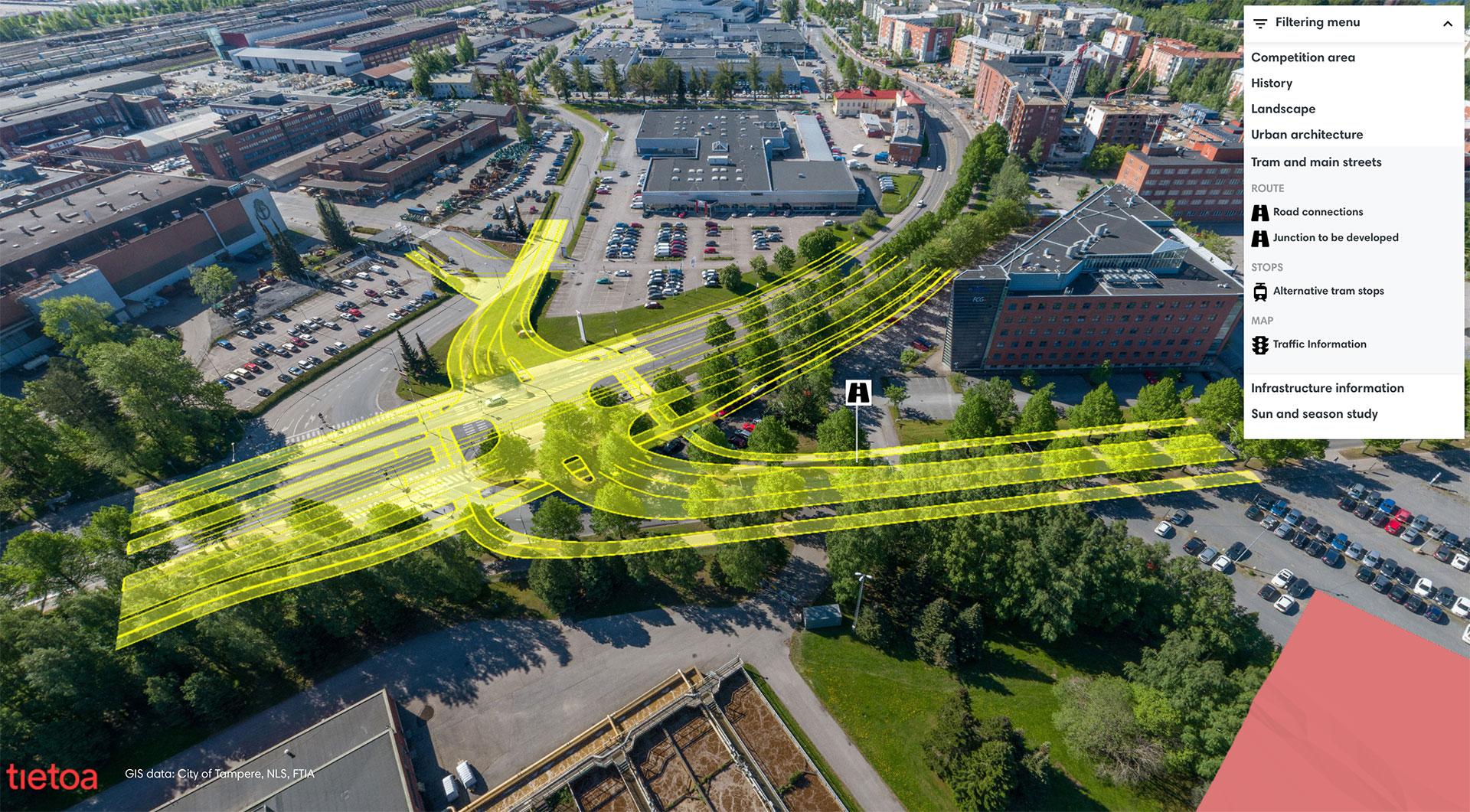
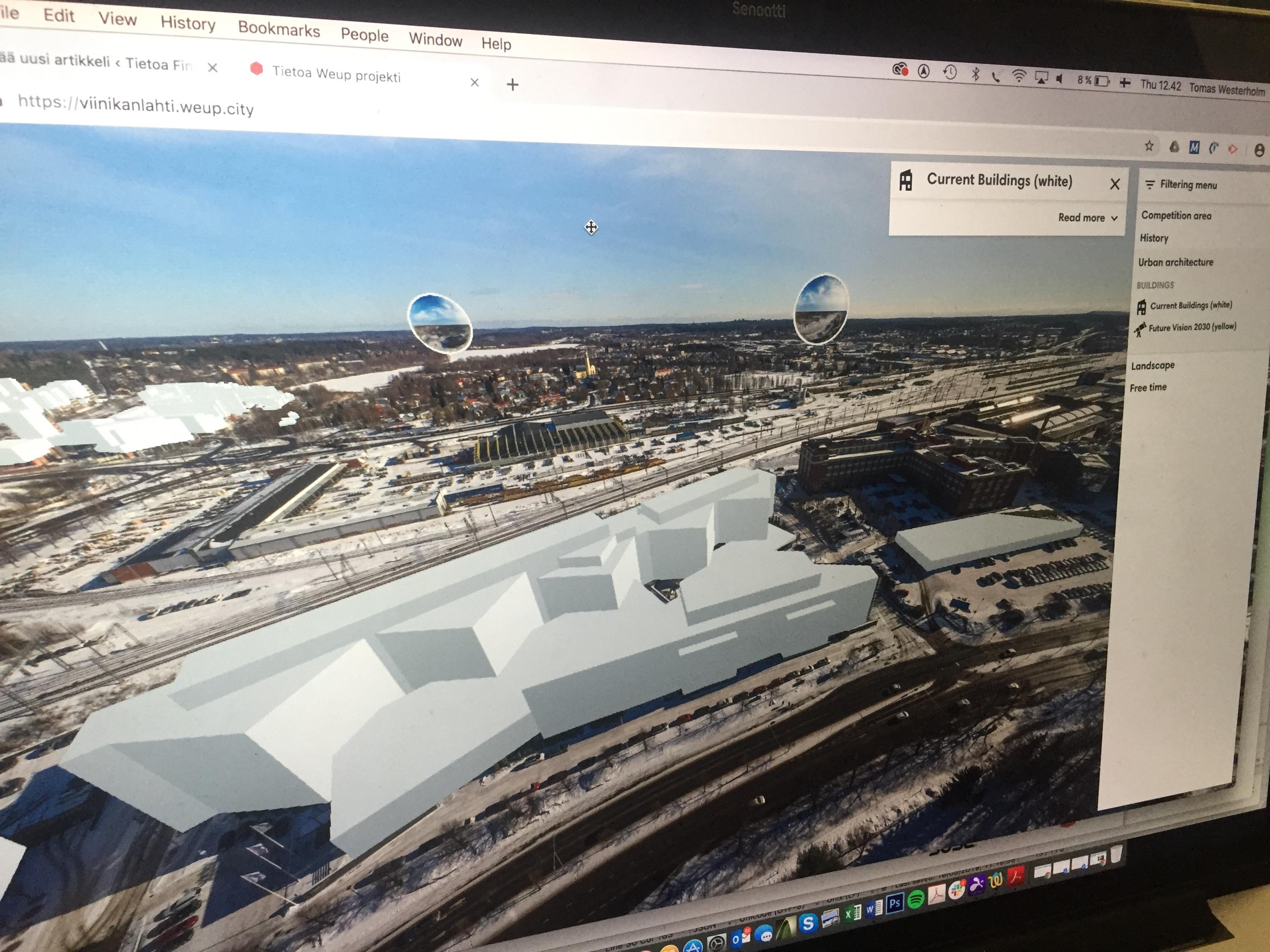
We are thrilled to announce that the public gallery of proposals for phase one of the prestigious architectural design competition for Helsinki’s upcoming museum building of architecture and design🏛️🎨 has been launched on Tietoa Competition Cloud platform.
Explore the visionary designs submitted by talented architects from around the world 🌍 and witness the innovative concepts that could shape the future of Helsinki’s cultural landscape. This open competition, organised in collaboration with Museum of Architecture and Design, is a landmark opportunity for architecture enthusiasts and professionals alike to engage with some of the most inspiring design ideas of our time.
Check out the gallery and stay tuned as the competition moves forward into the next phases. Let’s celebrate creativity and the future of architecture together! 🌟
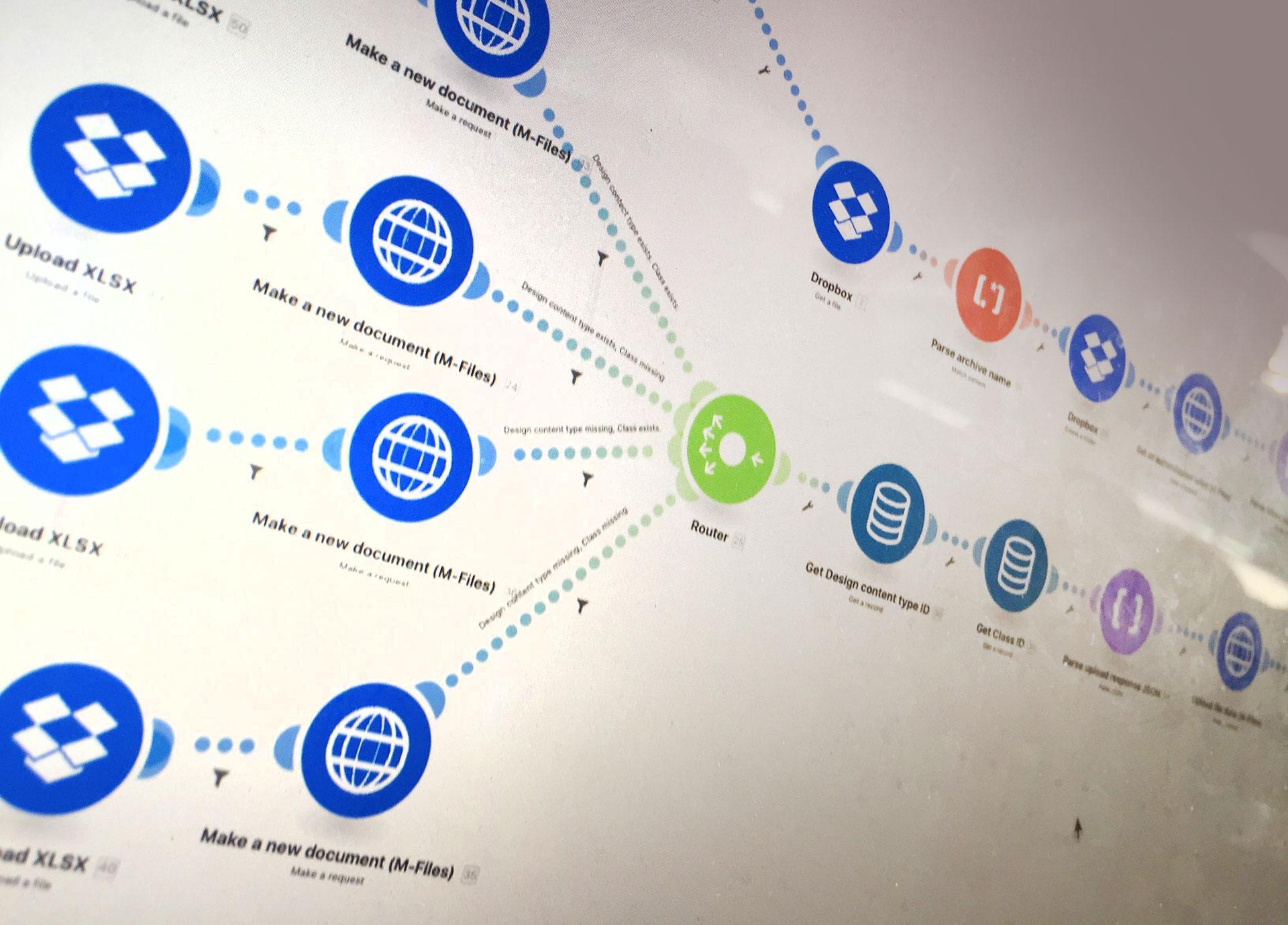
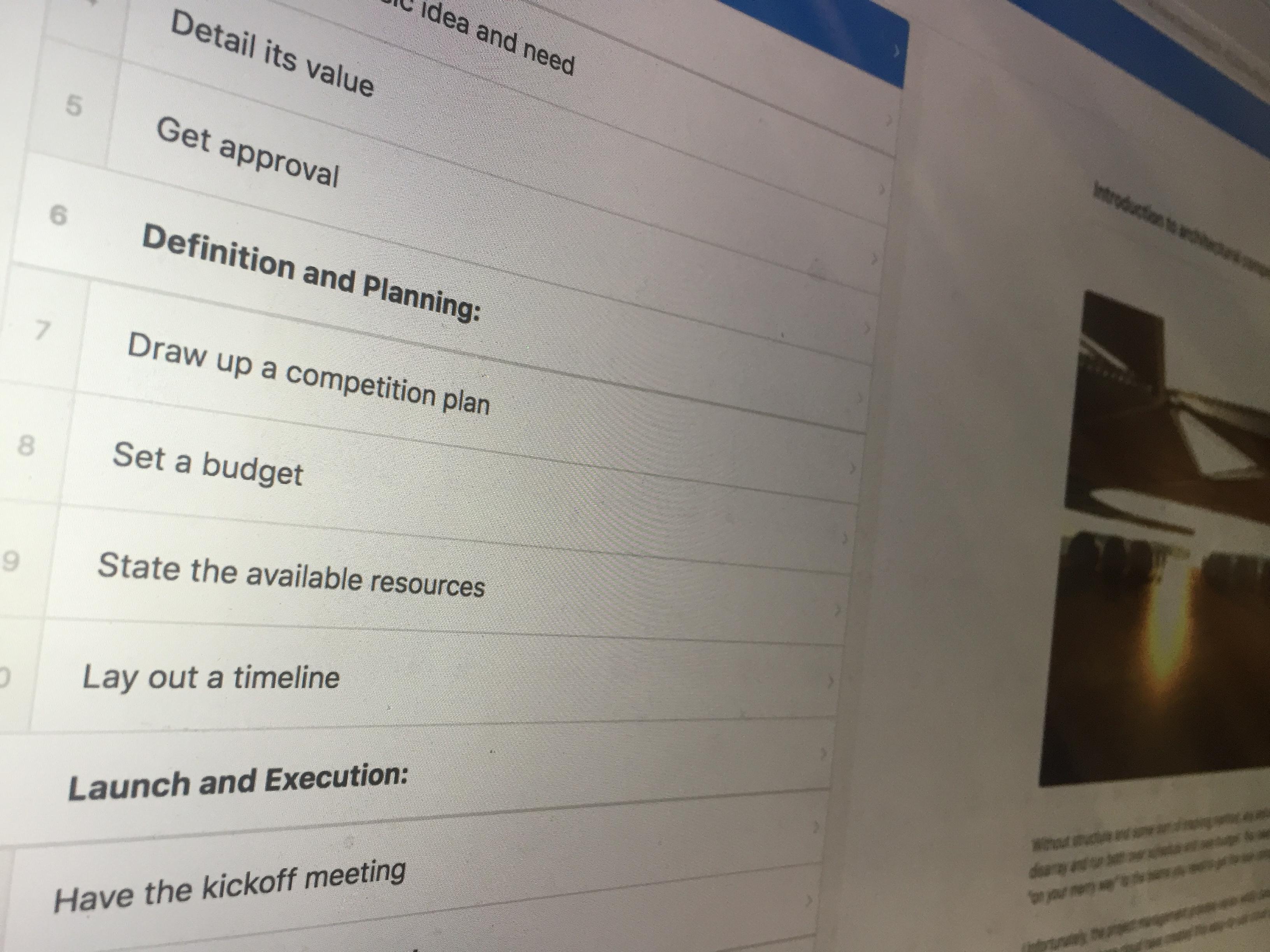
How it works under the hood for 624 proposals?
Competition Cloud offers a unique approach to running competitions, combining automation with expert-driven customization. This hybrid model allows for a perfect fit for any competition, whether it’s a small local event or a large international challenge. But what exactly happens behind the scenes to make this system so adaptable and efficient?
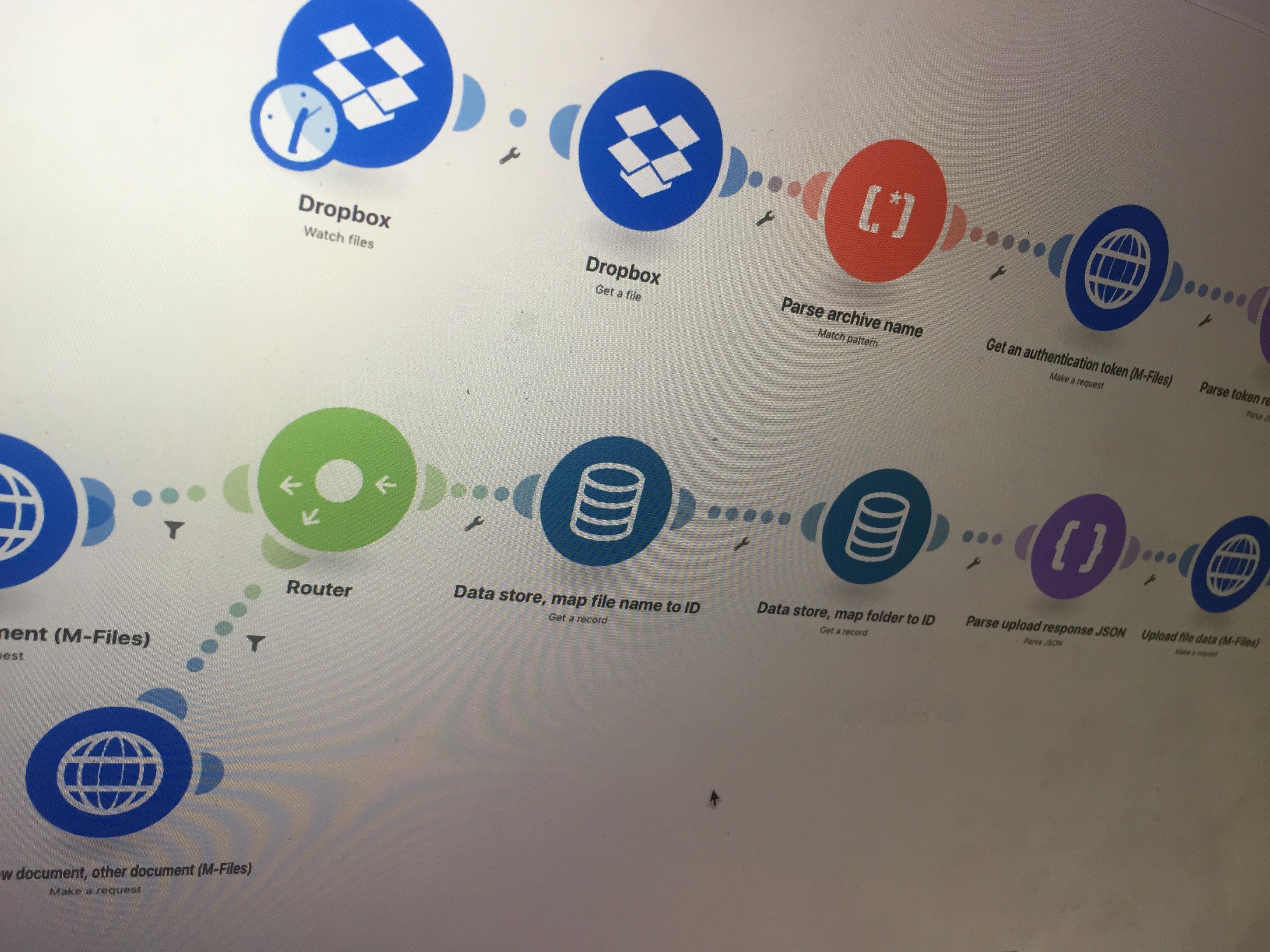
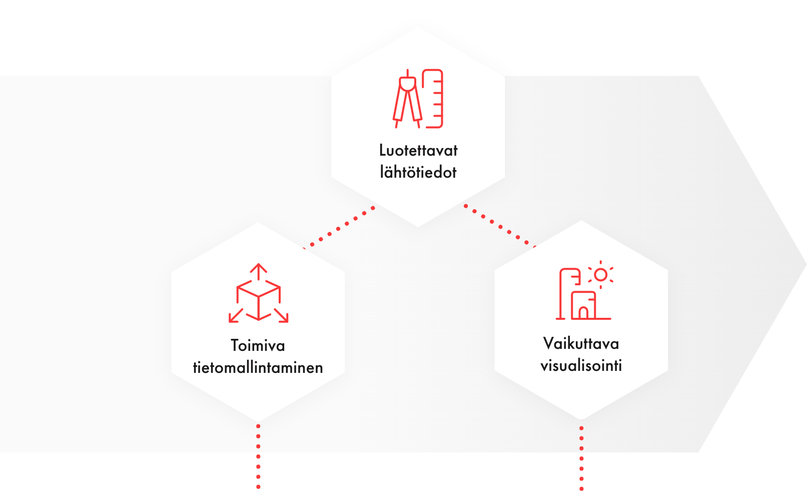
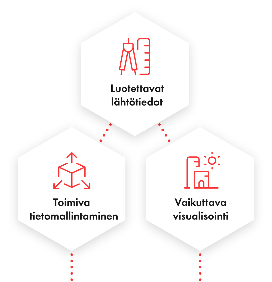
A Solid Foundation: Pre-Built Features At the core of Competition Cloud is a comprehensive set of ready-to-use features. These include tools for collecting submissions, managing participant data, and conducting evaluations. The submission process is streamlined, allowing participants to upload their designs, ideas, or proposals directly into a structured database. The system automatically processes these files, ensuring they meet the required formats and standards. This prevents errors and speeds up the overall competition flow.
Visual content, like architectural plans or design layouts, is processed into raster image pyramids, making them easy to navigate and review—whether you’re working from a high-speed office connection or a mobile 4G or 5G network. The result? A smooth experience for judges and organizers alike, who can sift through submissions and engage in discussions without delays.
Customization for Every Competition While the system’s built-in tools handle much of the heavy lifting, what sets Competition Cloud apart is its ability to adapt. Not all competitions are alike, and that’s where expert intervention comes in. As the competition evolves, specialists can step in to make real-time adjustments, ensuring that the platform aligns perfectly with the unique needs of each event. Whether it’s a specific judging criteria or additional features requested by the organizers, these modifications ensure that every competition runs smoothly, no matter the complexity.
Hybrid Efficiency: The Best of Both Worlds The hybrid nature of Competition Cloud means that it’s both automated and customizable. Routine tasks like submission management and initial evaluations are handled by the system, reducing the workload for competition organizers. Meanwhile, experts remain on hand to manage more complex tasks, such as adjusting evaluation methods or providing real-time support for unexpected issues.
This combination ensures that each competition benefits from the efficiency of automation without losing the flexibility that comes from human expertise. It’s an approach that delivers the best of both worlds: speed and adaptability.
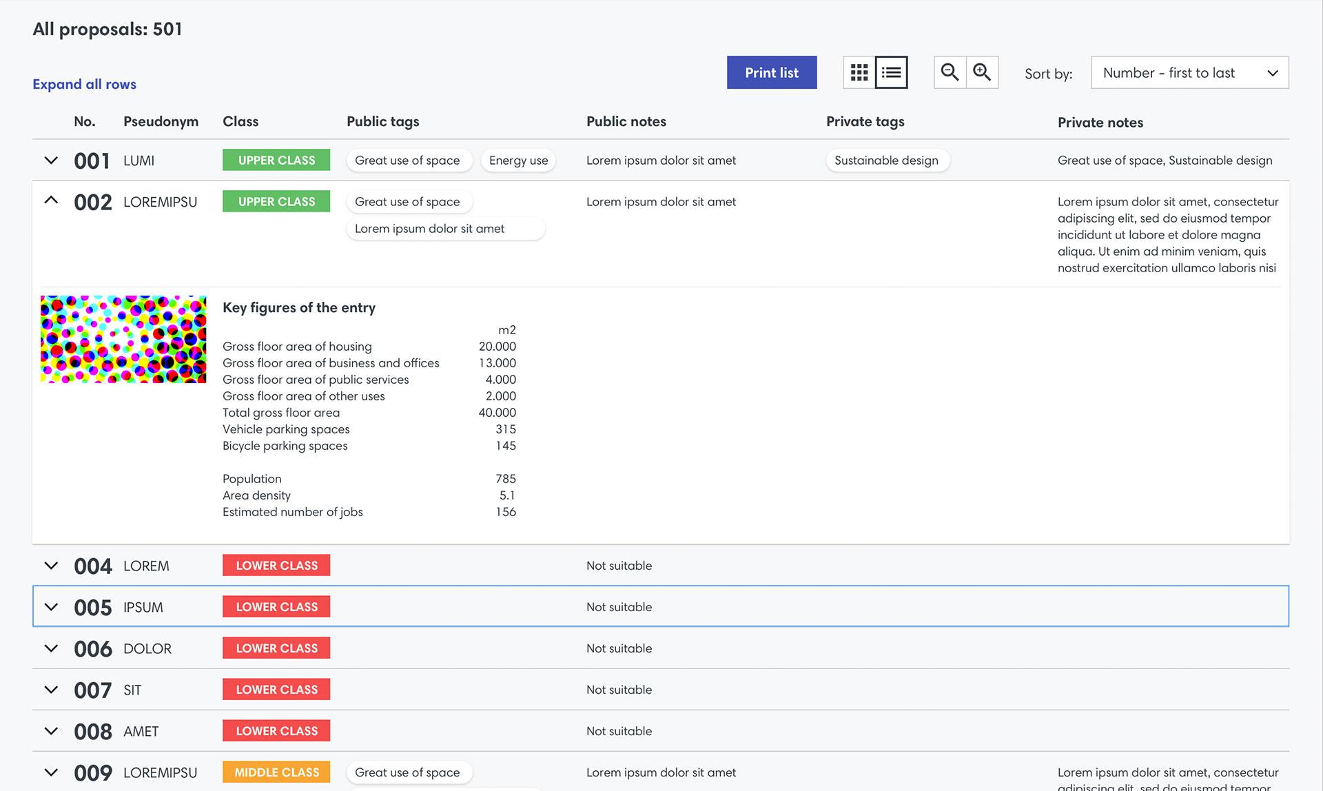
Seamless Collaboration Another key feature is the platform’s collaboration capabilities. Competition Cloud isn’t just a submission tool—it’s a space where judges, organizers, and participants can work together. With features like tagging, chat, and collaborative evaluation notes, the platform allows for clear communication and efficient decision-making. This makes the evaluation process more transparent and ensures that everyone involved has access to the same information, all within a secure and well-structured environment.
Tailored to Success At the end of the day, Competition Cloud is built to ensure success for both organizers and participants. It saves time by automating routine tasks, reduces errors by enforcing submission standards, and offers the flexibility needed to handle any competition, no matter the size or scope. Whether it’s a local architectural competition or a large-scale urban planning challenge, Competition Cloud can adapt to deliver a seamless, efficient, and tailored experience.
By blending automation with expert input, Competition Cloud delivers a platform that not only meets the needs of organizers but also enhances the quality and efficiency of the competition process itself.
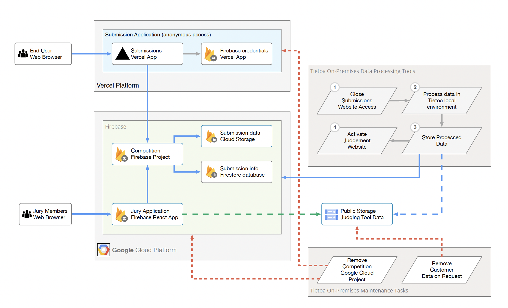
Overview of the Competition Cloud Process
Competition Cloud serves as a platform for managing competitions by handling submissions, processing data, and allowing secure access for jury members. It provides an efficient way to manage competitions through a combination of web-based applications and cloud infrastructure, ensuring smooth submission, evaluation, and data handling processes.
Submission Phase
- Competitions are opened to the public through a website.
- Participants submit their entries (usually PDFs with metadata) via an anonymous submission portal.
- Each submission is linked to a unique ID, which allows users to access and update their submission.
- Submissions are stored in Firebase, part of Google Cloud, and the process is secured through encrypted credentials.
- When the submission period ends, the portal automatically closes, and the backend system is locked to prevent further modifications.
Data Processing and Security
- Once the submission phase is over, Tietoa staff processes the data offline. This involves generating models or formats for the jury to review.
- Security measures include daily backups, 256-bit encryption for data at rest, and secure HTTPS/TLS encryption for data in transit.
- Data is stored in EU-based Google Cloud regions, with further options for specific secure storage zones.
- All submissions are processed in a secure environment, ensuring compliance with GDPR and other data protection standards.
Judgement Phase
- The processed competition data is published for the jury to review. Jury members access the submissions through a secure web application.
- Each jury member has personal login credentials managed by Firebase, and only authorized users can view the submissions.
- The jury platform allows collaboration between members without exposing personal details or confidential submission information.
- Public versions of the competition data can be published separately, stripped of personal or sensitive details, and made accessible via a public website.
Data Cleanup and Removal
- After the competition concludes, the data related to the competition can be retained or removed at the customer’s request.
- When requested, Tietoa will remove all related data by deleting the Vercel applications and Google Cloud projects. This includes removing backups and any public data shared through cloud storage.
- The platform has strict procedures in place to ensure complete data removal when requested, maintaining compliance with data protection regulations.
Security and Backup Protocols
- The document outlines the robust security features of the platform, including encryption and regular data backups.
- Submissions are stored securely in multi-tenant environments, with physical and network security measures provided by Google Cloud.
- The platform ensures data resiliency through geographically distributed backups and hourly backups retained for 30 days.
Summary of Tools and Technologies
- The platform relies on Vercel for managing web applications, Google Cloud for storage and data processing, and Firebase for handling authentication and database services.
- Tietoa’s on-premises tools are also used for processing submissions and managing competition data locally.